 I can’t even blame an alcoholic stupor for inadvertently booking onto a cycling expedition across the Pyrenees. I just simply forgot that I don’t like going up hills that much and got starry-eyed and blinded by the thought of being the first person to cycle from the Atlantic to the Med across the Pyrenees.
OK. Let me clarify that.
- I don’t drink. Except on special occasions like cycling up the Tourmalet
- I might have been the first person to cross from coast-to-coast that week. Though probably not.
- I really don’t like cycling up hills.
 I went with a friend or two on an organised trip. You could quite easily organise the same trip yourself but I figured that it was WAY easier to have someone carry my stuff in their van. There are lots of organisations doing very similar trips including Raid Pyrenean, Exodus and Marmot Tours. The former seem to want to complete the trip in 4 days and 4 hours. I took longer than that and like to think that my route was harder, higher and involved more alcohol than theirs.
I’m fit. Nevertheless it was tough. I did, sort of, train for it via HIM training.
In hindsight, the Pyrenees is not as hard as you might think when you look at some of the elevation profiles further on in the post. Most recreational cyclists would relatively easily be able to complete the sea-to-sea trip and throw in a few famous TdF cols in 6 or 7 days. IMO it’s NOT as hard as an Ironman, although it is tough in a different way eg whilst I have done many relatively hard rides of over 100 miles I’d never done them on back-to-back days.
Enough of me. This post is about ‘Gadgets on Tour‘. As, once again, the Magnificent 7 of Wahoo, Polar, Garmin, Humon, Shimano and Favero explore places new. OK. OK. It’s 6 I know. 7 sounds better.
Lists
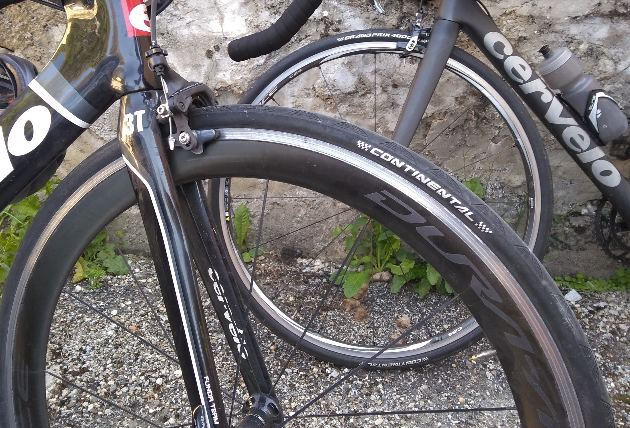
Kit List: Cervelo S3 road bike (possibly inappropriate and s/be the R3); appropriate Wahoo Elemnt; Polar Vantage V + Polar H10; Garmin 935 + HRM-TRI; Humon Hex; Shimano Di2 + other Shimano Bits; Specialized Evade + Saddle; and lots of bits of lycra including some new Boratesque bib shorts from ASSOS (birthday present, thank you). The Shimano DuraAce C60 wheels were probably not as inappropriate for the WHOLE TRIP as you think as there were many sections that were not hilly – I did have a tubeless climbing wheel option but didn’t fancy the faff of getting a non-self-sealing puncture.

Ocean List: Atlantic and Mediterranean.
Col List: d’Osquich, d’Aubisque, du Soulor, du Tourmalet, d’Aspin, de Peyresourde, des Ares, de Portet-Aspet, de Pailheres, and some others that I can’t be bothered to list as I think I’ve included the ones that might impress you already 😉 …or not. The climbs added up to 1.5x the height of Everest…or so someone in my group said.

Achievements
This illustrates my competitive streak whilst effectively on holiday. My somewhat spartan achievements included:
- Not falling off or breaking anything.
- Not losing anything.
- Occasionally (but not often) beating a proper cyclist to a, usually secret, random point of my choosing on the route.
- Top #1 Strava segment (climb)…for one day. We started early and I made sure I immediately uploaded the stats at the top of the col and then logged into STRAVA for a screen shot as ‘proof’ of my awesomeness. I thought I had done particularly well on that day and saw no point in logging in to Strava later in the day as I couldn’t imagine anyone going faster. Hmmm.
- One top 10 Strava segment position…all time. Yay…I now have 2 Top 10s.
- Doubling the number of calories I normally eat and not putting on weight.
- Not getting cramp.

Moments of idiocy
Hey! We all do it.
- My regular reader will know that my bike handling skills leave something to be desired. So going down a sometimes bumpy mountain road and topping 85kmh was scary (data verified by ALL my devices and moderated by STRAVA). If I had the right gearing and could take my speed through the hairpins at more than 5kmh I could see how it would be possible to go a lot faster. #Scarier
- Arriving without charging up my Di2: As DCR knows, I change gear a LOT. Because I can. Luckily I had the foresight to bring a charger for everything, including Shimano Di2.
- Charging everything. Every night. I keep the main devices recording all the time during the day, even during stops (it’s what I do). So everything needed charging to ensure it could complete the next day. The idiocy moment was only bringing one international adapter. It was all fine, although I think the 935 ran out of juice towards the end of one day but it didn’t miss anything of note.
- Having the Humon Hex ‘Interval’ CIQ data field on display for the first-day #Sigh. Changed to Endurance data field.
- Not having a special page full of climbing stats on my Wahoo. Though I did remedy this after a couple of days. I’d previously never really saw the point of having to show ‘grade’. Finally. I understand.
- Drinking alcohol most evenings
- Doing a Polar Orthostatic test every morning (ish) when I didn’t really want to and being sceptical that it seemed to always say that my Cardio system was good to go. I finished the trip, so I guess it was good to go.
Highlights
Apart from the unexpectedly perfect weather here are some photo highlights and associated gadget insights and comments. The words and images are about the trip with a commentary for each day but there is a paragraph or two for each day on a different aspect of the tech. After all…it was their expedition too 😉
Day 1
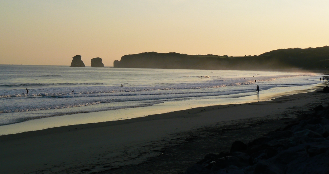
Starting out at Hendaye you have a nice beach with the sea on your left. With some trepidation, you know that in a few days time you will be at a different sea and it will be on your right. Just like on the maps.
 But the maps and atlases of school days soon give way to the full glory of STRAVA which simultaneously give you a bird’s-eye view of the route as well as the devilishness of the climbs to come.

We start in Basque country. They either have their own flag or their kids are very poor at colouring in the British Union Flag.
You can see, below the flag, the obligatory Garmin Edge devices already on the table before we had even started cycling. There were also a notable number of Wahoos on the trip as well. The times they are a changin’ Mr Garmin.
But what struck me most was that after each day’s ride we would all use STRAVA. Obviously, I’ve used STRAVA before but never quite in this way where everyone sits around a table and tries to find a particular angle on STRAVA where their performance was in some way, somehow, better than everyone else’s. Such competition was all good-natured but the way that STRAVA was being used was surprising to me (and obviously useful as we all had it to compare like with like).

In the Alps a few weeks ago I seem to remember that I figured out depth-of-field. But I’d forgotten again when it came to the Pyrenees..
So; I found it much easier to stop trying to be a clever photographer and resort to basic shots like this to prove where I’d been. 500m a.s.l. ! Pah. Nothing. as we shall see.

The stats said that day 1 looked something like this

But my memory is NOT enjoying the beautiful scenery but rather staring at the road. The view was mostly like this but from a slightly different angle

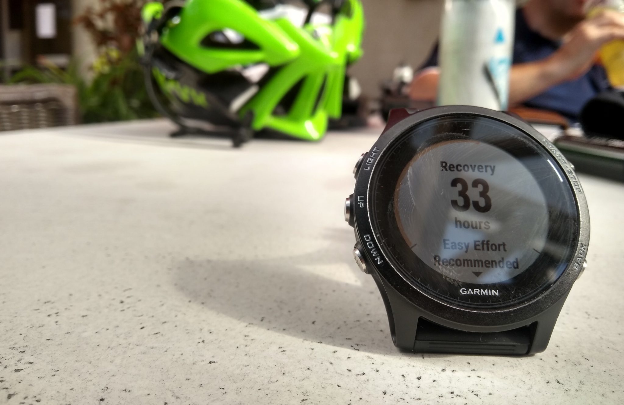
The stats still haunt you though at every turn and at every pint of beer. It felt like I would need more than the 33 hours shown below to recover from just one day of cycling but Garmin said ‘No’. I survived Garmin’s predictions of cumulative doom and, by the end of the week, I had pretty much broke Polar Vantage V’s training status measure. More on that later.
Day 2
All the images might not be quite in the right order. You’ll get the drift of things…Flat bit…long uphill bit…super speedy downhill bit. Each one blurs into the next. Each one typically involved at least one bloomin’ great big hill. Like this on day 2

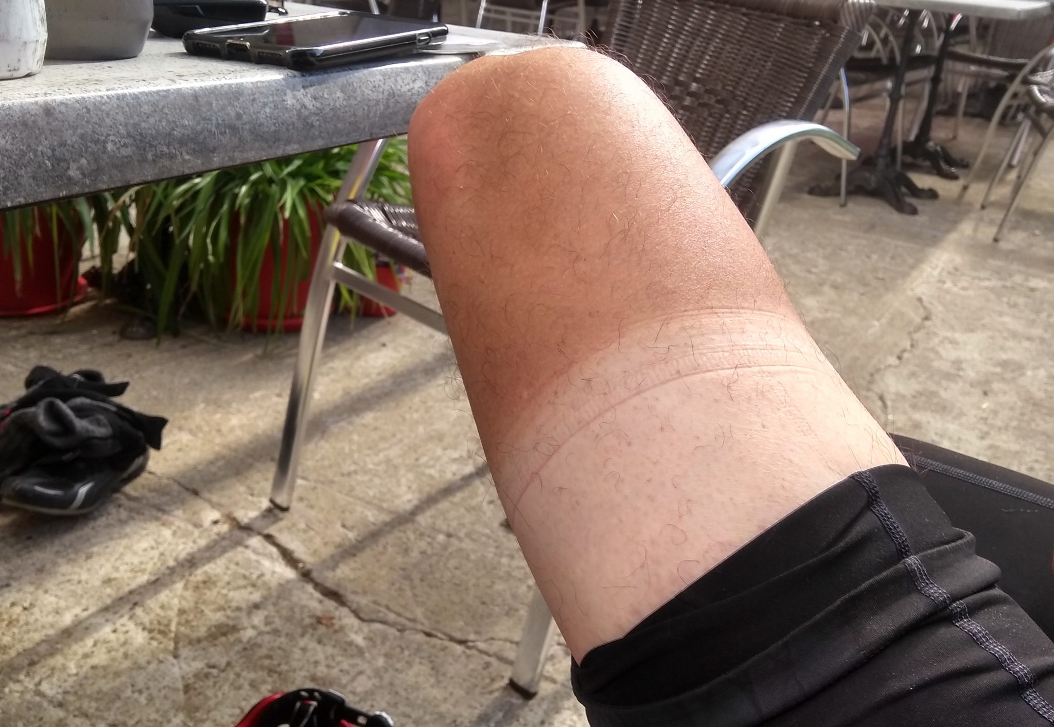
Some of those travelling with me knew my ‘secret identity’ as the5krunner and a few others kinda realised that the ‘idiot always taking pictures of a watch‘ had an ulteria motive. Anyway I promised AB his moment of fame and here it is. He was/is one of the proper cyclists on the trip and this was the sun tan to prove it – BEFORE we even set off. AB probably trains as much as me per week but JUST at cycling AND he also has better genes (and a better bike, Cervelo R5). Although I’m not sure his legs look better than mine…
One thing I like about France is that there are wall murals (indoors and out) that look cool to me as a Foreigner. Maybe London is the same to someone from France? Maybe, but I don’t think so.

Anyway, despite that looking pretty cool that coolness was not how I felt at the top of the Col d’Aubisque after many 10s of minutes of exertion. This scenery was relatively unusual for the Pyrenees and more ‘starkly stoney’ than elsewhere on the trip. Beautiful, nevertheless.
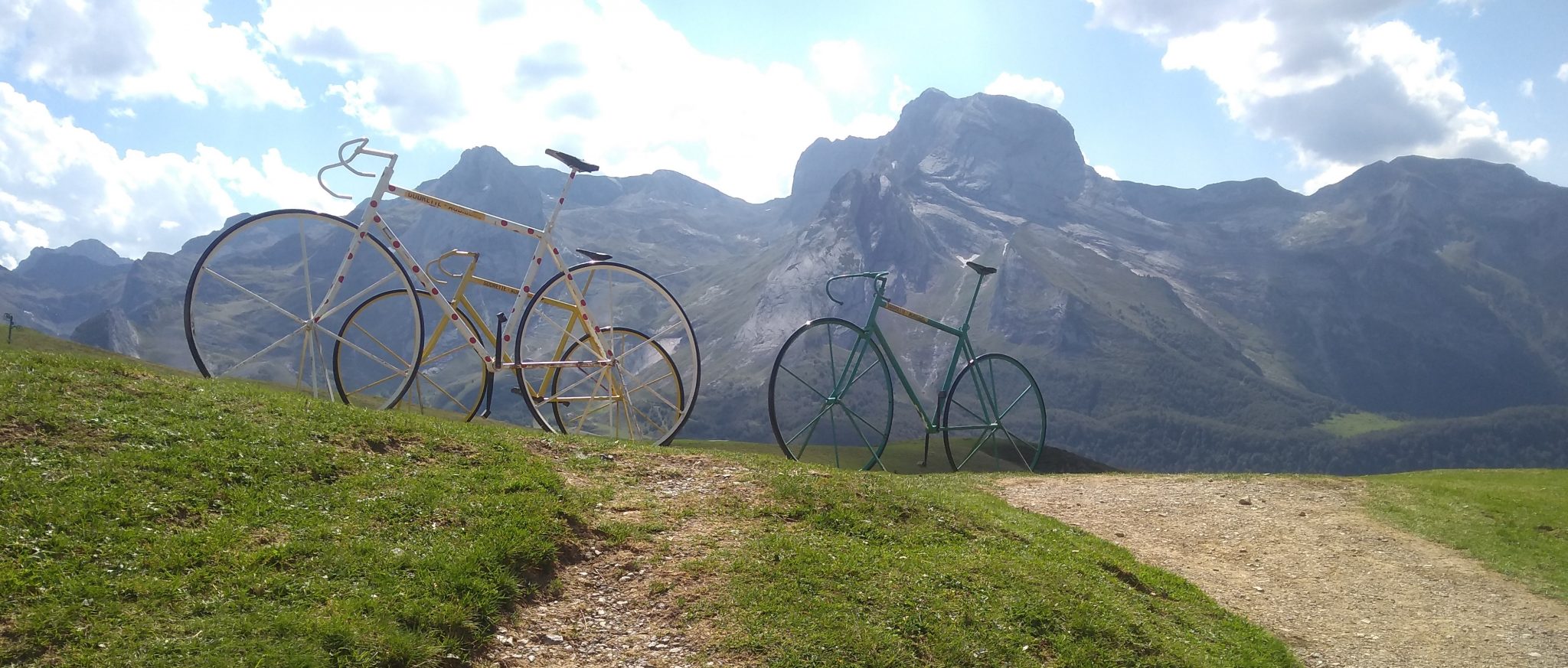
The great thing with the Col d’Aubisque is that there are no kids BUT there is a kids’ playground…aka some bike statues (to the left of the image). The ‘grown ups’ can have hours of fun taking photos of themselves climbing on them. As it’s France there are: no health and safety warnings; no-one to shout out at you, or tut-tut; and nothing is fenced off.

like this
I also love the signage both at the top and at the bottom of all of the climbs. I suppose the stickers are graffiti or vandalism. They DO, however, seem to add a somewhat visual experience to international cyclists’ shared statements of solidarity against the elements,

Then it was on to the Col du Soulor. This chart is probably how Garmin’s ClimbPro would look if I had managed to get it working. ClimbPro probably would have helped the pro’s (hence the name) but I suspect that, if anything, I would have found it a little de-motivationing to know that there was so much more climbing to do each and every time I looked at the Garmin Edge/Forerunner.

Day 3
There was no such thing as an easy day. It started out at breakfast. I had to eat about 3 or 4 times as much as I normally would. Fine; if you like eating. But day after day it got progressively harder. Still, maybe those extra calories were why I didn’t cramp up? #NotABadThing

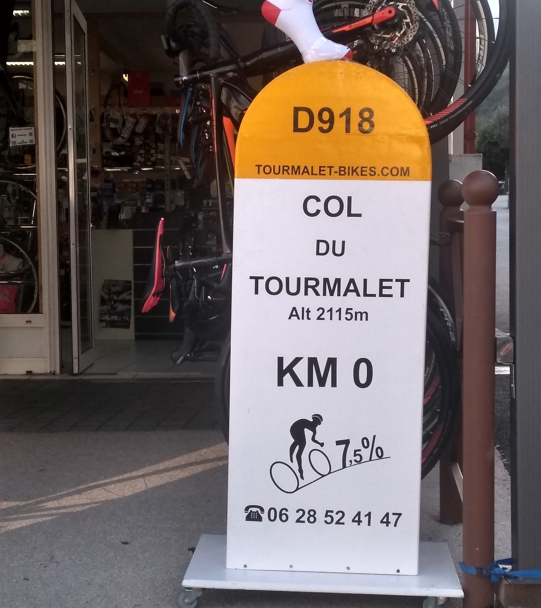
The shops have got in on the “somewhat morbid-looking climb monuments“. They look live gravestones. but in a nice way. This bike shop seemed to be doing good business. Whilst the signage advertises the ascent it doesn’t always tell you how far you have to go. With the Tourmalet it was something like 19km of CONTINUOUS climbing probably mostly at a 7-9% gradient on a good road surface. Trust me, it’s going to take you more than an hour even if you don’t stop. Probably WAY more than an hour for some of you. And then you will have AT LEAST another 4 hours of other cycling later that day too which, as you can see above, involves yet another non-trivial climb for a mere mortal.
When you do finally get to the top of the Col du Tourmalet the staff at the local cafe are very welcoming. Unless, that is, you are a member of Team SKY.

The Tourmalet is the famous place with that statue that some of your friends have had their pictures taken in front of and posted on those Facebook pages that you were never too sure about. Yet, when you get there you will probably do the same thing.
I didn’t.
Instead I took a picture of my Wahoo Elemnt and my lovely Speccy helmet. It’s what I do. I’m happy. Leave me alone. I don’t hurt anyone else ;-). The pretty Polar Vantage also photo-bombed this one

One of the great things about having the Wahoo was that it just did precisely what I wanted it to. It’s vaguely nice to look at but the screens/controls have been thought through by someone who understands cyclists rather than an engineer assigned to a UX/UI team. You can just see in the picture above the final part of the climb on the Wahoo (it’s the way the device is facing as the picture was taken). Trust me. When you are going down the other side at 40mph you REALLY want to know what is coming up after the next blind corner or you want to know how steep the next bend is. Most other CycleNav devices have prettier screens but they kinda over-pretty the info you really need to know ie the stuff that could kill you at >40mph. Red lines, blue lines overlaid with an as the crow flies line…c’mon I just want to CLEARLY know how steep the next bend is. It’s not so bad in the UK as normally road signage is good and, for example, the black/white chevrons on tight bends indicate the severity of the bend…that REALLY is NOT the case in France.
Suunto gave me a ‘snood’ a while back (thank you SP@Suunto). I was never quite sure what to do with it. I now know that it is great to put under a helmet to drain away the head sweat. It’ll probably add some warmth in winter too. Here’s the payback…Suunto on the Tourmalet..covered in my stinky head sweat. Livin’ the dream.

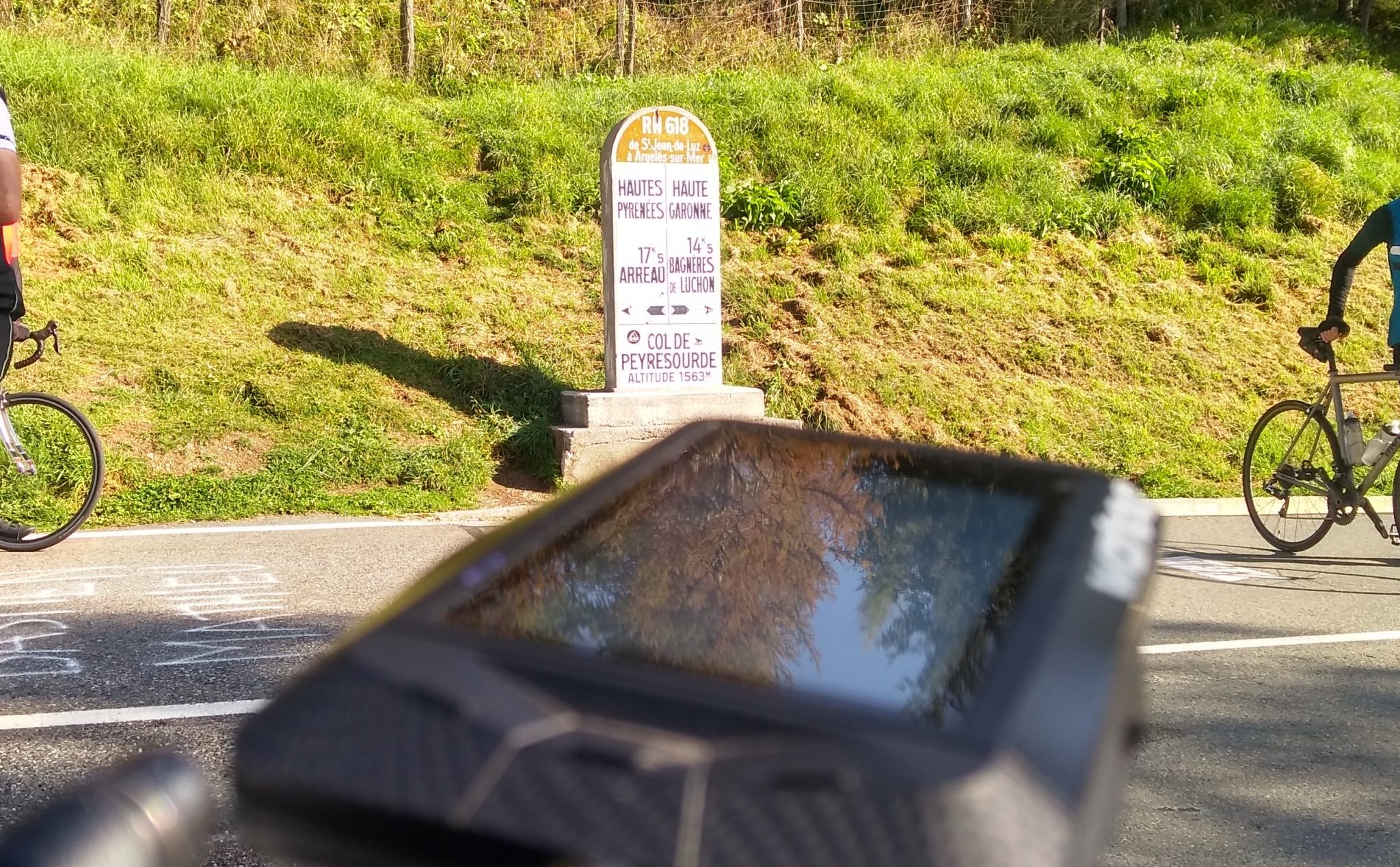
A little while later, a little hill later and yet another sign to take a picture of.
 Whilst the descent down from the Tourmalet was a little hairy for my liking I soon gave up worrying about crashing and burning. The descent down from the subsequent Col d’Aspin, if memory serves, was one of the speedier and safer ones AND LOTS OF FUN. No time for photos.
Reflecting on Day 3 I browsed over my stats on Di2Stats.com and, unsurprisingly, my time between shifts was increased due to relatively long and constant mountain grades. In this case shifting was increased to 17.3 secs b/t shifts.

Here is a screen shot from a hilly ride a few weeks earlier.
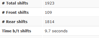
There are lots of other interesting gear stats on di2stats.com, although I’m not entirely sure I went up Tourmalet with a 23T 😉 Looks like I forgot to manually set all the numbers of teeth on the gears. Grrrr. (Sensor options in the Garmin and via the sensor config on the Elemnt app)
 Also this stuff which tells you what gear/cadence you favour for what kind of grade
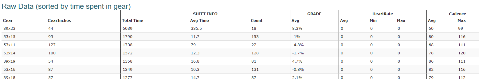
Hmmm. My frame is a bit like Dan’s. Strange that.
Day 4
Day 4 involved the mighty Col de Peyresourde as well as the Col des Ares and the Col de Portet d’Aspet. The mapped out plan looked something like this.

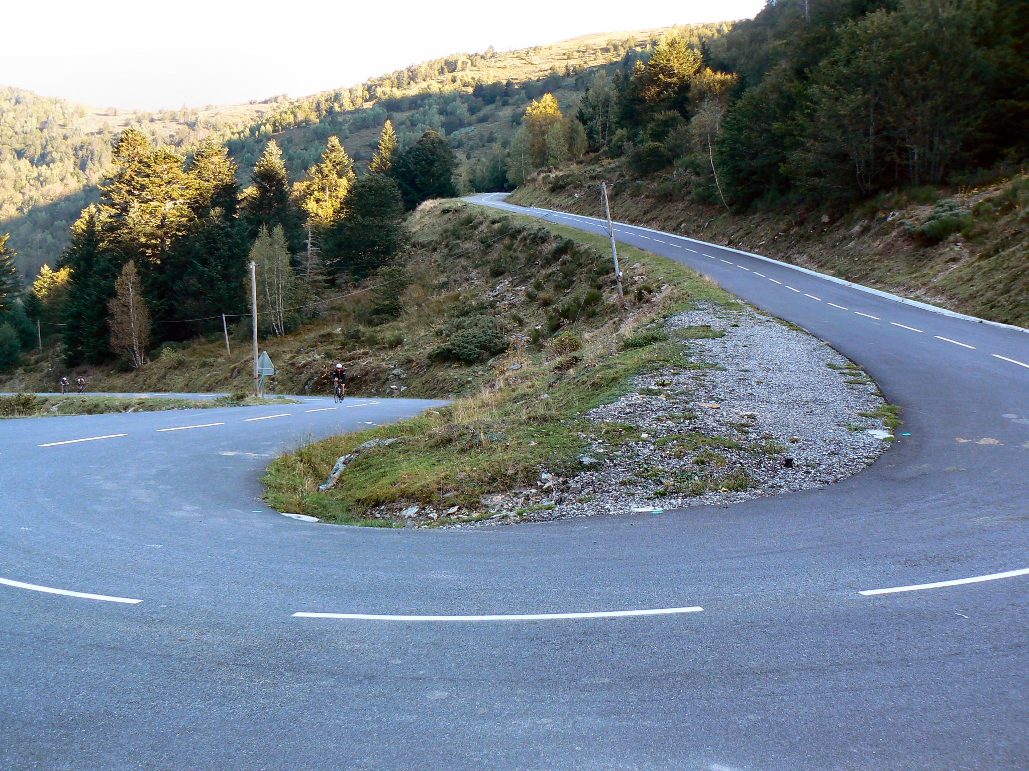
Day 4 had a good decent or two as well as the 3 climbs. I think this image was on the way up to the Col de Peyresourde after which the downhill would soon get bendier and MUCH faster than in this uphill segment. Pretty tho, huh?

Again!! It’s day 4 but I still haven’t learnt about depth of field.
The cols soon started blurring together in my mind. There were so many of them. There were also a lot of cyclists, even in September, who were celebrated and welcomed in equal measure throughout the Pyrenees. Errr….at least the thoughtful ones were:
 Soon enough, a mere 800m hill almost seemed like a downhill section to look forward to.

Moxy
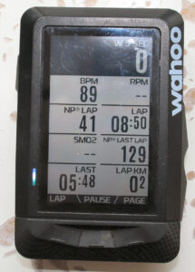
By this point I’d spent quite a lot of time staring at the Moxy endurance data field on the 935 which was stem-mounted and facing the wrong way by 90 degrees…BUT it is colour-coded and green was still green (oxygen) and red was still red (much less oxygen) regardless of the way the Garmin faced. The Moxy seemed to detect quite well the point at which the going got tough. That was the point where it changed colour and seemed to get a tad harder (below around 50% SmO2), it seemed I could keep GREEN as a ‘forever pace’.
I also developed a technique that seemed to work for me when I could no longer spin sufficiently well. The technique was; every 5 minutes, or so, I would choose a slightly smaller cog and get out of the saddle for 30 seconds and perhaps spread the load onto some other muscles.
No doubt I’m not the first person ever to invent that. HOWEVER what WAS interesting was when I did that the SmO2 levels notably increased by, say, 5%. I took that either to be that I was recruiting other muscles and resting the quads or that blood flow to the thigh (RF) was made easier by my standing position. Or both.
There wasn’t much time to debate the finer points of getting up a hill before another one arrived.

Day 5
A double whammy.

Day 5 looked hard. I’d need all the gadget help that mankind could muster.
I did fiddle with my Wahoo screen layouts at some point during the week in an attempt to create a better climbing stats screen. I ended up with something like these images (which were taken later)


- Main Screen – this is my ‘general’ screen at the moment. The SmO2 automatically added itself and I haven’t yet removed it. As soon as I hit ‘lap’ on my left Di2 button, I tend to look at the lap screen as my main one.
- Lap – This is my current ‘lap’ screen and I probably use it most of the time. Be it for a lap of the park or just at some appropriate point where I decide to press lap. I’m definitely interested in instant power/HR and, less so, cadence. But the cumulative lapNP is useful when I am going for specific lap efforts – Lap NP is higher than Lap Power so it gives me a fuzzy warm feeling that I’m doing better than I probably am. Knowing what my last lap time was & last lap NP is a useful indicator for if I need to up the effort a little. Distance and SmO2 have crept in for no apparent reason that I can remember.
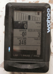
- Climb – This was the main screen that I added whilst in the mountains and, towards the end of the week, I used it a fair amount. The elevation profile at the bottom showed the upcoming hill (I was following a course/route) and it gives a decent indication of how far and high there is left to go as well as being zoomable. The grade data field is there to give me something to moan about to the person who is riding next to me and the gears at the top are a pretty cool way of confirming that there really are no more gears left, even though I would like there to be at least one more.
- The Map screen was most useful for pointing out the nature of the next blind bend. #Safety. But also for navigating assuredly through towns and villages.
- On the easier days and sections I thought I would try to rectify aspects of my pedalling (in)efficiency. My LR balance and right-side efficiency seem to have gone to pot and need to be improved. If anything, looking at the stats for extended periods made my technique worse. And I think the current imbalances were all caused by trying to improve my technique a couple of years ago. #LessonThereSomewhere
- I do NOT regularly use STRAVA Live segments so there is no screen for that. I still have nightmares from when I last had STRAVA LIVE on my Garmin. The Edge seemed to remind me every 30 seconds how far I was behind “SCT” (a friend). I was always behind SCT, even on social rides and, to be frank, I’d kinda forgotten what his face looked like if you get my drift? (aka always starting at his backside).

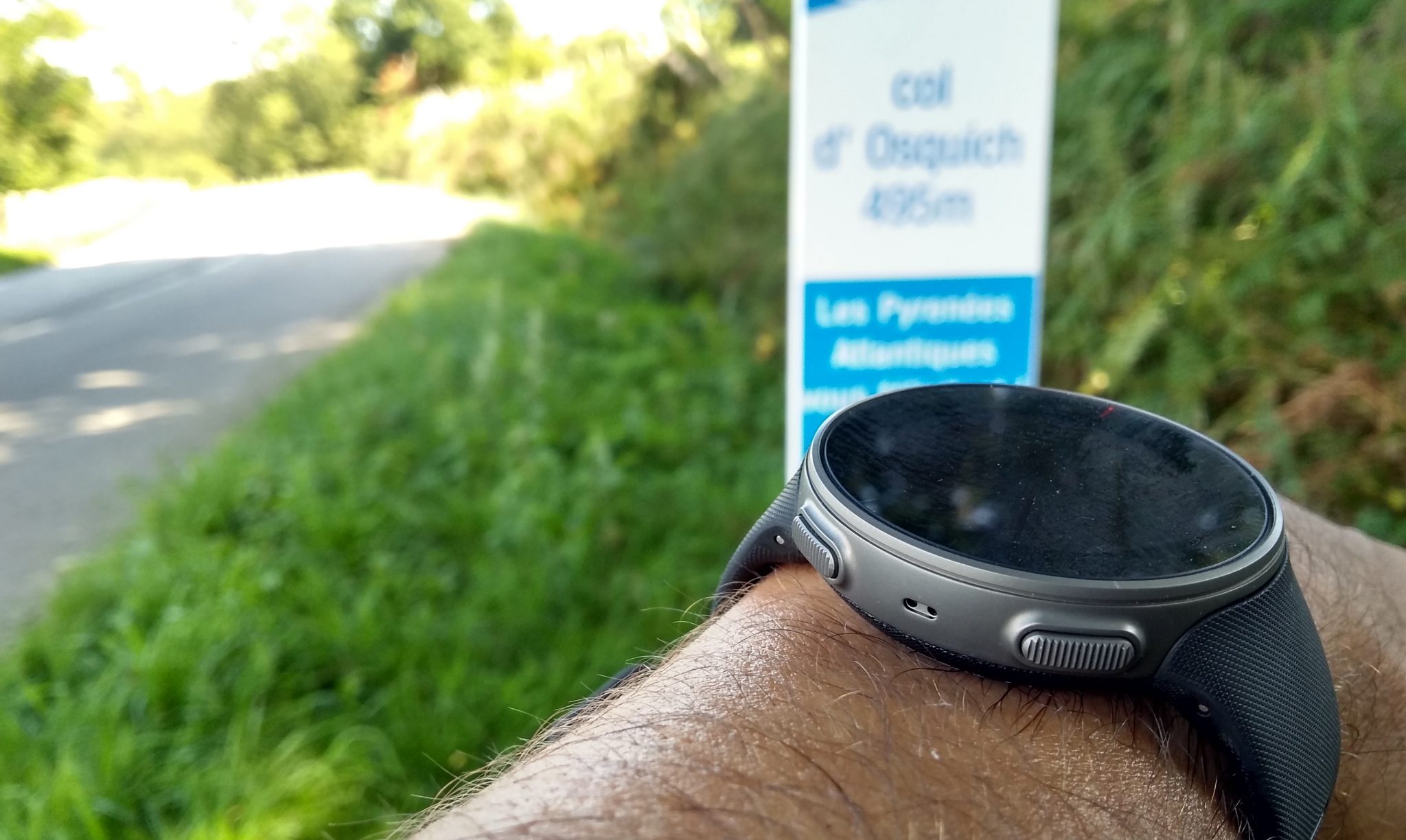
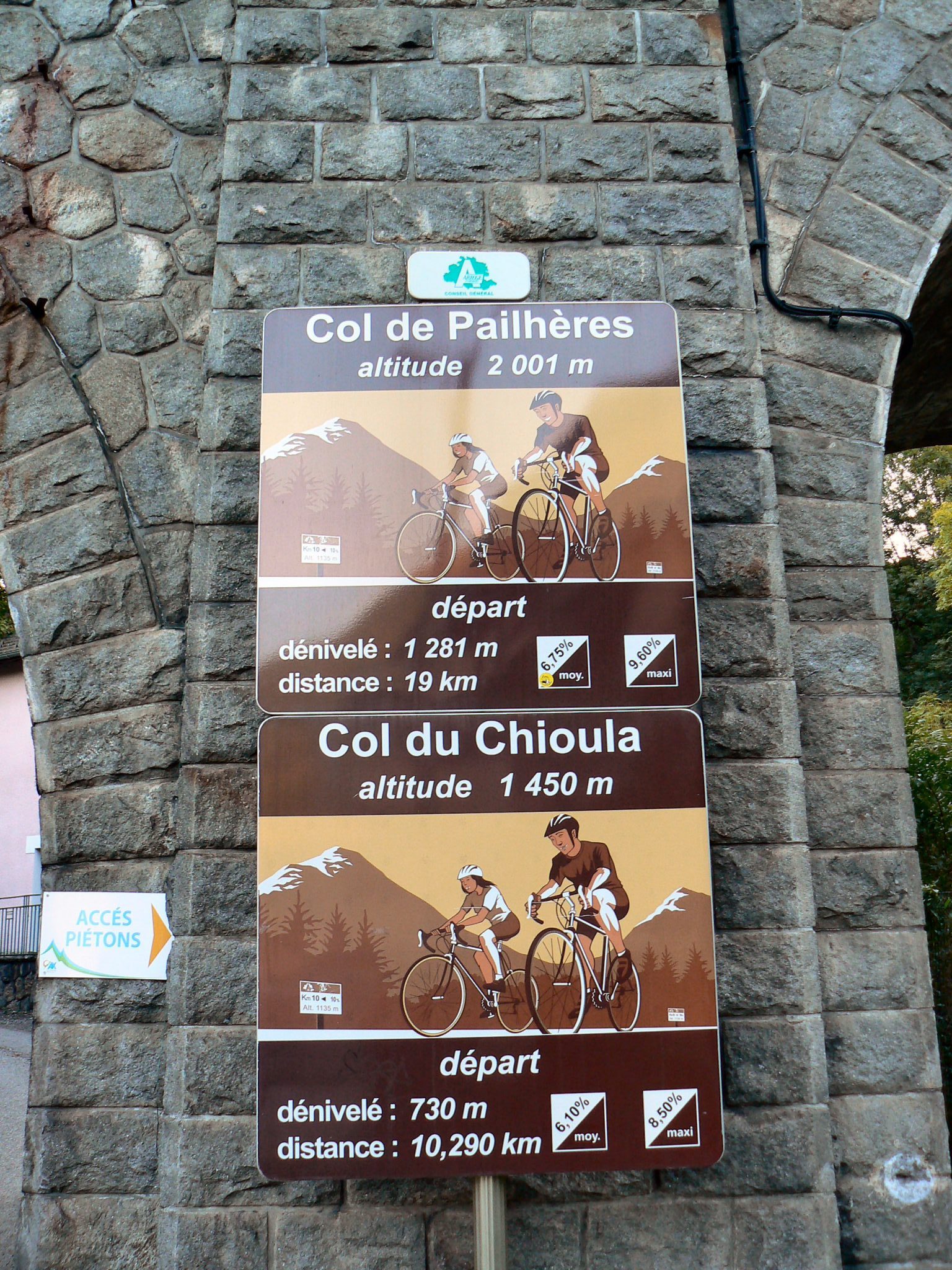
The Col de Port was followed by the Col du Chioula.
The sign below invited us to “Pick a hill. Any hill”. Actually it didn’t really matter as we did them both but on different days. Today was the Col du Chioula
Day 6
This was my favourite day. Mostly because I was still able to cycle and was still alive.
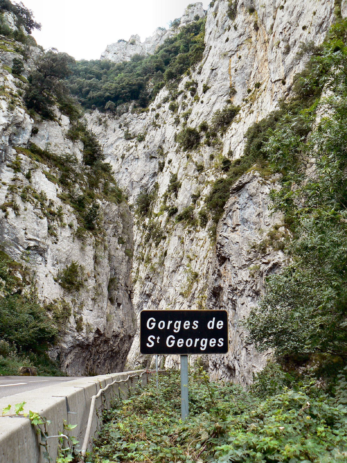
I felt able to try hard today both on the Port de Pailheres, which I almost enjoyed, and also on the fast, downhill, down wind and freshly resurfaced roads to the coast which also passed through the intriguing Gorges de l’Aude.

With all the carbs from the previous night’s two pints of lager, I felt sufficiently fuelled to tackle the way up the Pailheres. By this point in the week I had developed a cunning STRAVA hill-climbing tactic for riding in groups. Here it is…
STRAVA Tactic: At the bottom of a climb you have to feign some sort of mild mechanical or clothing issue. This ensures that you start up to 30 seconds behind everyone else. The rest of the group will likely chat and generally faff around as they start the climb and you catch them up. The key thing to remember now is that, according to STRAVA, for someone to beat you on the climb segment they now have to beat you by 30 seconds. When you get to the top and are properly tired then you can slack off a little and graciously let someone else just ‘beat’ you by 10 seconds or so (aka they were going to beat you anyway). You just have to stay relatively close to them. Back at the hotel, where it counts, stats and STRAVA will tell you that you beat that person. Stats don’t lie. The other person will also be happy as they technically beat you, albeit they were slower. Hey. Everyone’s literally a winner.
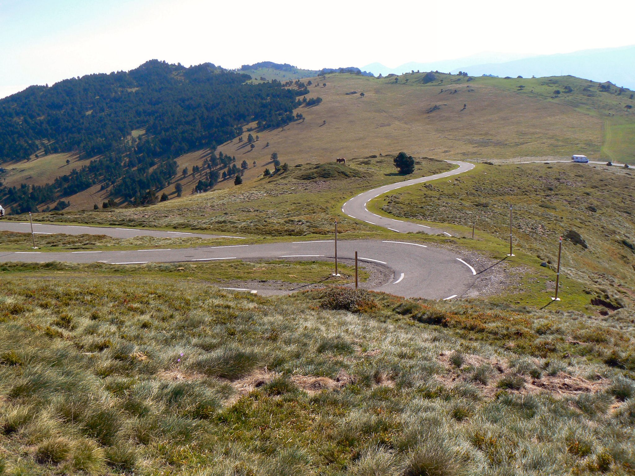
There are two separate series of twisting ‘Italian Job‘ bends on the climb up the Pailheres. I think these are the first bends.
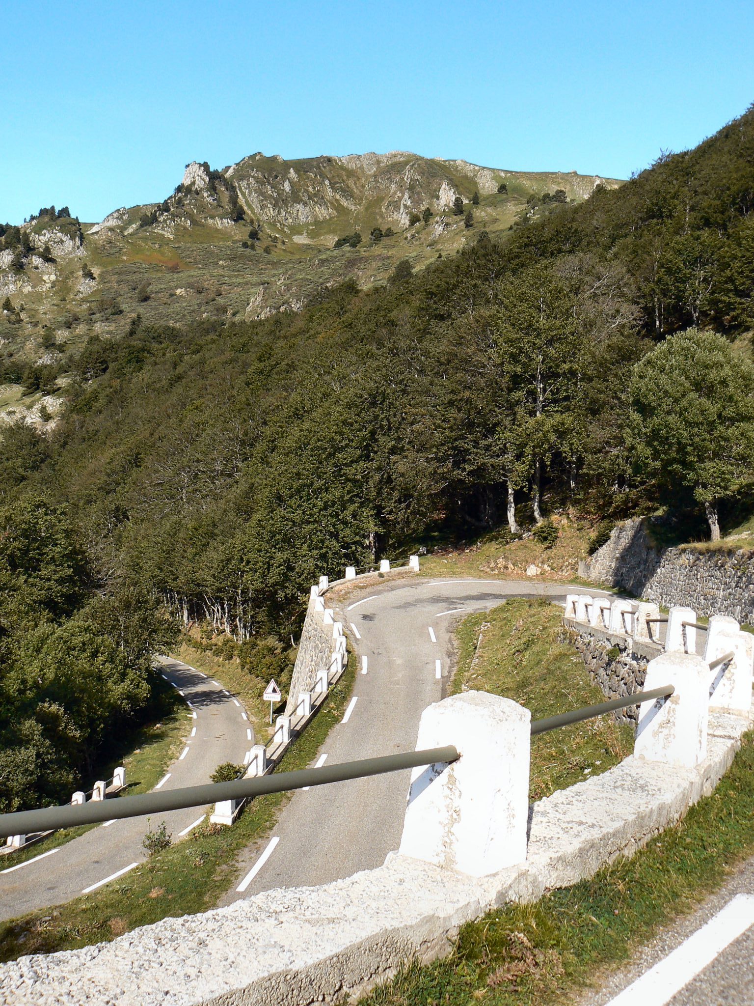
And these the second lot. I could be wrong.
This bend, below, looked a bit like Box Hill. Then again, I suppose all the thousand or so other bends did too. I think this is taken from the point in the image above where you can just see our support van parked on a bend.
MOXY told me I was ‘in the red’ whilst on much of the ascent to Col de Pailheres. My SmO2 dropped progressively from somewhere around a comfortable 50% to a scarily low 20+%, or so. And it dropped quite rapidly once in its red zone. I hoped, at the time, those low figures were from climbing over a kilometre into thinner air but I guess the reality was that I was trying pretty hard to get up a steep hill after 5 previous days of doing exactly the same thing..

In hindsight, trying a bit harder and consistently in the high 20s %age of SmO2 might have been sustainable for a longer period tht what I achieved.
Like me, the more studious amongst you will climb the Col de Pailheres from the West and, having read up on the climb, will realise that there is a false ‘summit’ at the car park. ‘SMILE’ politely as your opponent grins and speeds away from you towards the car park “summit” and then burns out. At the car park get out of your seat and sprint to the real summit. These people are your friends so just THINK the word ‘LOL’ and DO NOT say it. Never say LOL to a beaten cyclist, especially if they are nearly always better than you.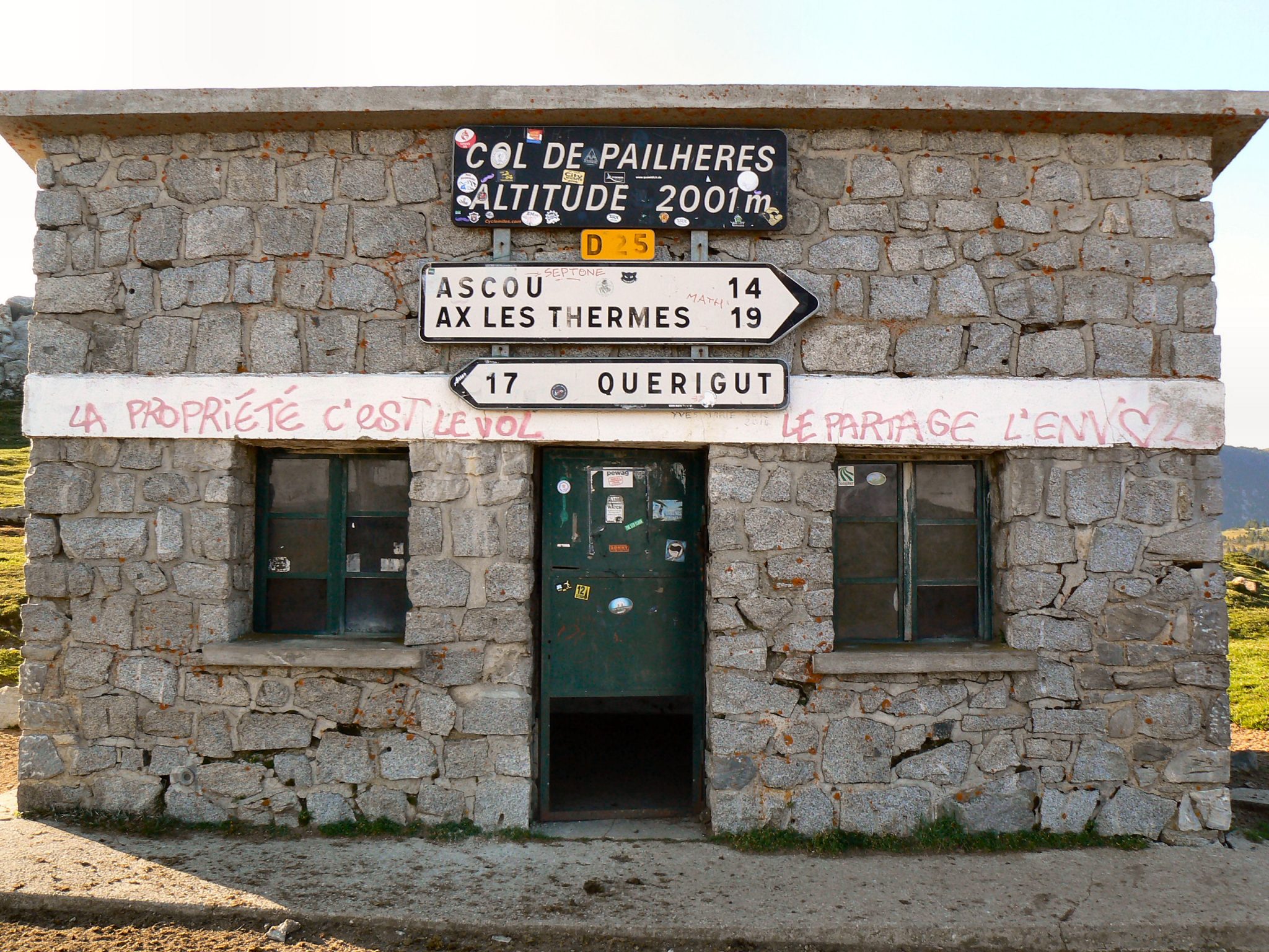
The start of the technical element of the descent was great, as shown below, I hadn’t yet regained my mojo and didn’t really enjoy it as much as I could. I’d been practicing leaning my bike into these bends and was told that I should keep my bike more upright and, instead, lean my body in. That made me nervous. And I REALLY wanted to fully enjoy the super-speedy bit that was to come. Basically a time trial….and I DO know how to do time trial efforts.
Beautiful gorge. Blah blah. Where’s the time trial bit? I’m waiting.
I haven’t got any images of the descent to the coast but it was truly awesome and fast. The whole group burnt every match we had left and worked together as a group pretty well for extended periods.
If proof were needed of a hard week in the saddle, the Polar Vantage V told me I had had a slightly harder than average time. Ahem…off the scale ..almost…do I win a prize?

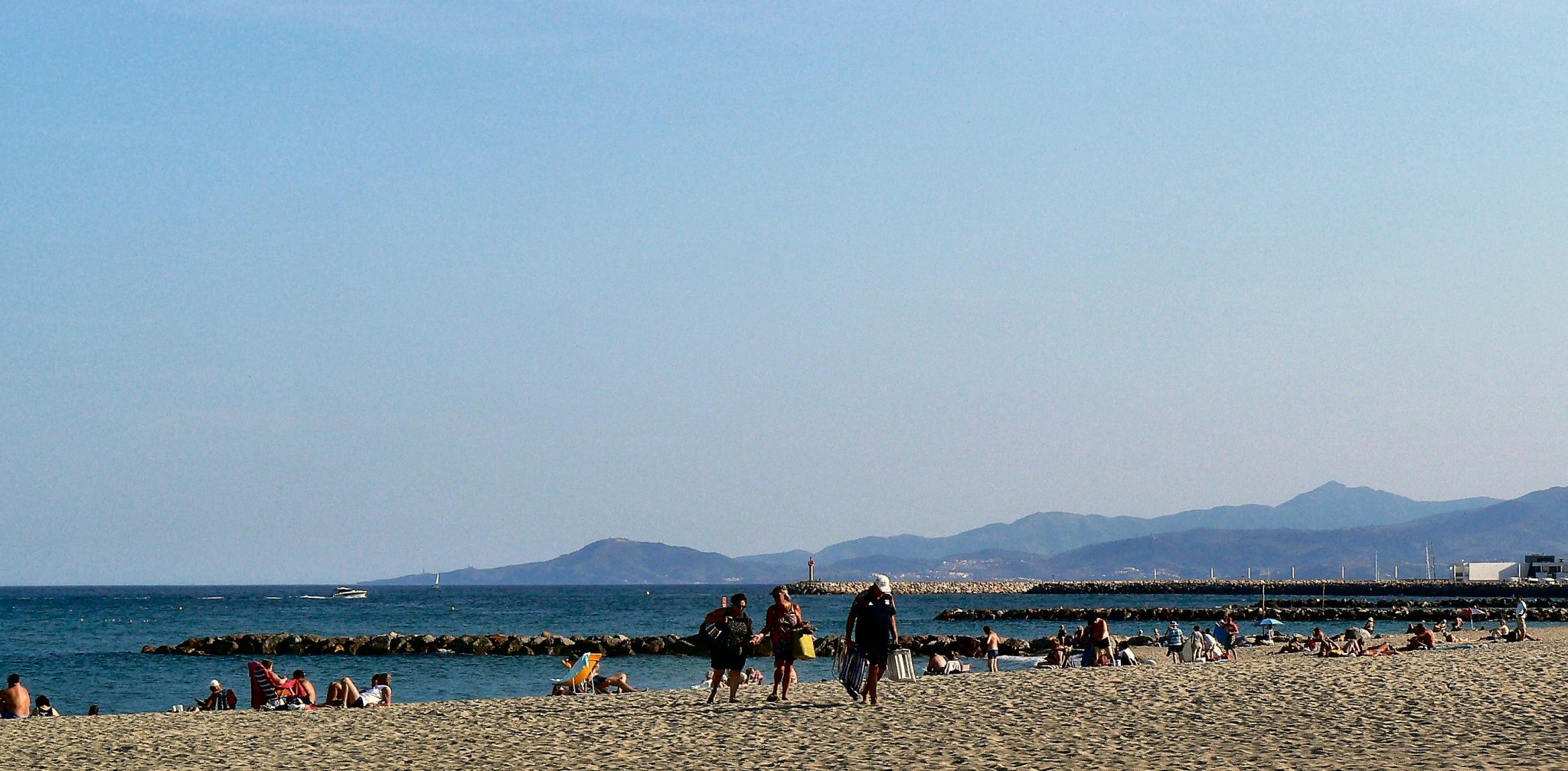
Disappointingly when we got to the other Sea I found it still to be on the left just like when we started. #Confused. The more intelligent amongst you could perhaps explain this geographical conundrum to me.
 Coast-to-coast is a great experience and I’ recommend it just for the achievement. From a performance point of view I didn’t hit a single power-PB for the entire week but, on my return, I’ve already hit a 3 minute power PB and bumped my FTP up 5watts. #HappyCamper
#Ends
Reader-Powered Content
 This content is not sponsored. It’s mostly me behind the labour of love which is this site and I appreciate everyone who follows, subscribes or Buys Me A Coffee ❤️ Alternatively please buy the reviewed product from my partners. Thank you! FTC: Affiliate Disclosure: Links pay commission. As an Amazon Associate, I earn from qualifying purchases.
![]()
Have you got some updates about firmware and feature development on the vantage?
there is a new fw today but i don’t have the details of what’s on it. non beta. v1.02
i’ve already put in that question
the roadmap shold hopefully come nearer to public release ie this/next month
edit: all this info now published today by me