STRAVA Routes – Personalised, Heatmap Routing for 2020
 Today STRAVA rolled out a great new addition to their route offering. In a nutshell, it gives you a means of creating a personalised, popularity-based, round-trip route.
That’s all you need to know but if you want to read some more about it, let’s go.
Background
STRAVA has had generic route functionality for some time. With varying degrees of awesomeness, you could manually draw, save and sync your own routes and you could also look at STRAVA’s local guide where there are a few curated rides/runs, like these for London.

Which is great for visitors to Central London, as with the case shown above, but perhaps less great if you are nowhere near any curated route.
In the past, you may have relied on other navigation devices for clever, on-the-fly routing options when you are somewhere new. I’ve used the round-trip routing on the Mio Cyclo 505HC / 605HC and round-trip routing on the newer Garmin Fenix models. These both work well in some respects and less so in others. For example, Mio is a smaller company and doesn’t have popularity data for its routes – actually, I think the Fenix is similar in not using Heatmap data (IIRC) even though Garmin does have heatmap data on Connect. Yet, even several years ago, the Fenix was able to generate turn by turn instructions with street name labels as well as giving an elevation profile of the route it created.
Let’s see what STRAVA can do in 2020.
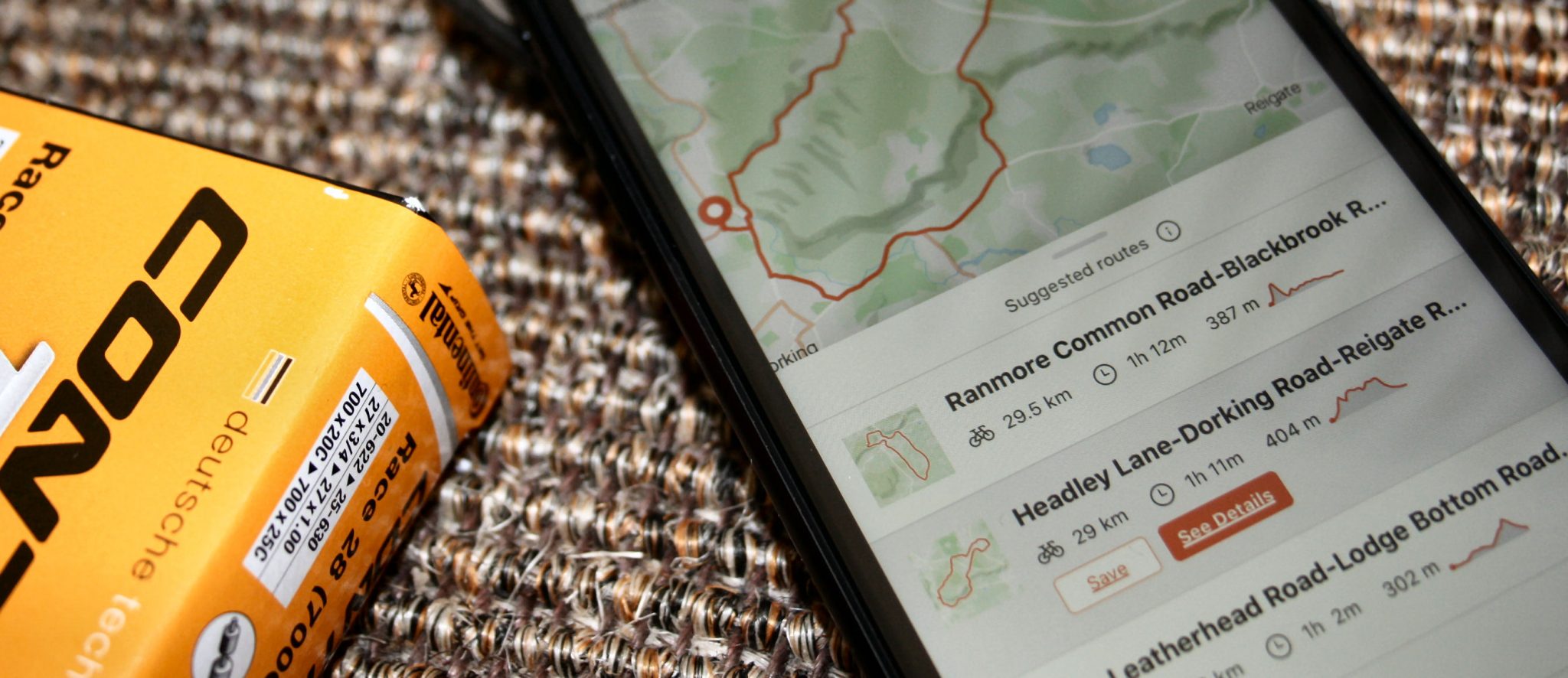
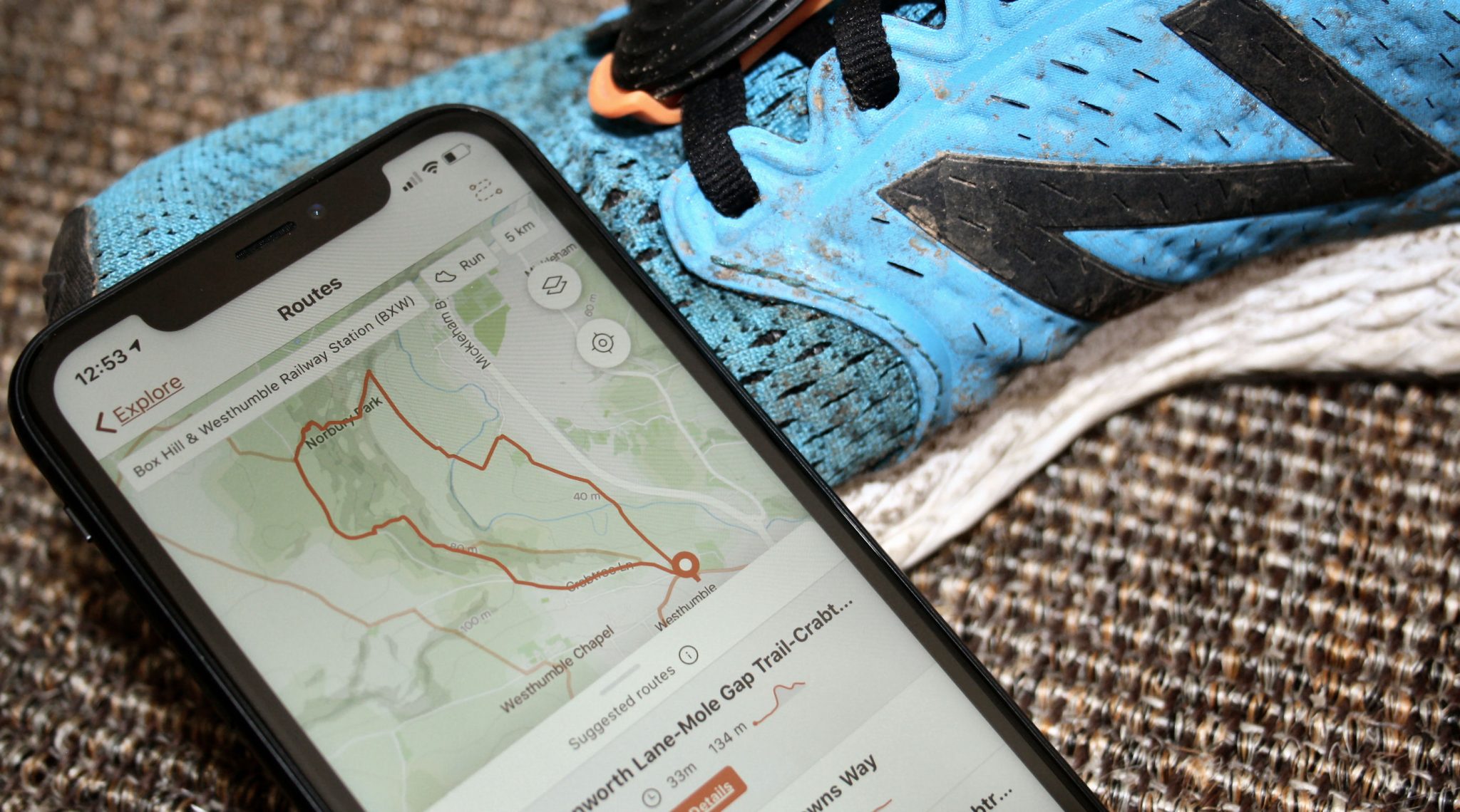
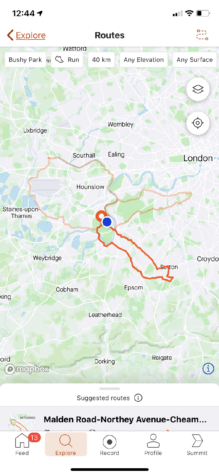
new Heatmap Routing – Basics


- Start/End Point – You can choose where you are now or search for a point like ‘Box Hill’ and you get a good series of points to choose from such a search.
- Ride/Run – Self-explanatory.
- Distance -Running presents fixed distances from 2km to 50km (ouch) and cycling from 2km to 160km, which all seem reasonable.
- Elevation – Flat, Hilly or based purely on popularity.
- Surface – Dirt, Paved or any/popular
When you have finalised your criteria, STRAVA presents you with 3 route choices which you can see outlined against each other on a map or which you can drill down into for more details. The final image of these 6 shows the elevation profile as well as the type of surface on your chosen route.


You then save your route and it will sync to connected devices as normal and, if you’ve saved it as a public route, you can share with friends.
new Heatmap Routing – Problems
In my opinion, heatmap routing is potentially awesome and offers the potential of big leaps forwards in getting your from A to B (or in this case, A back to A). There will inevitably be a few problemettes but I’m talking here of 9 steps forwards and one step back. So overall we should see near-awesomeness. But, hey, nothing’s perfect.
The first problem with a heat map is the heat. Many companies’ data sets might only produce coolmaps or tepidmaps or lukewarmmaps. But Garmin, Google, Apple, STRAVA and maybe a few others have the potential to produce scorchingmaps. ie jam-packed full of data that’s scorchingly relevant to the routes that you might follow.
Here it comes.
However. People use STRAVA for all sorts of annoying reasons like ‘going to work’ or ‘recording a walk as a run’. So STRAVA’s heatmap has the potential to include the A309 (freeway) or some other major road in a part of its automatically created route for you. You are on holiday and you don’t know that the A309 (freeway) is full of cars. Well, at least that all could be a problem but it seems not to be. Yay! The few cursory checks that I’ve made show STRAVA is having a good crack and generally missing out commuter routes. I don’t quite know how they’ve done that but they do allow us to tag rides as COMMUTES, so maybe that was part of the exclusion algorithm that enables them to present generally sensible routes?
That was the major problem for built up areas and I think they have at least started to address that. Other issues are ‘what is the surface type’. You can see in the image to the right that STRAVA have a crack at defining PAVED and DIRT surfaces but this particular route has over 61% labelled as UNSPECIFIED, much of which is a good trail surface (part of the Thames Path), indeed parts of the route shown as unspecified are in fact paved.
On SHORTER cycling routes I found there to be more problems. That was because these tended to be in built-up areas and so perhaps the routes took in too many junctions. Out in the countryside, the routes seemed much more sensible and also sensible for running. Indeed some of the suburban/urban running routes STRAVA has come up with only slightly further afield from where I normally run, look VERY interesting.
Another ‘problem’ is that this feature is only available to SUMMIT/PREMIUM subscribers. I’d say…’Fair enough’. STRAVA have to make their money somehow and this feature will have value to some people.
new Heatmap Routing – Interesting Bits
Here are some factettes
- When using an iPhone, STRAVA used Apple’s maps for me and also used Map Box for my Android phone. Neither showed STRAVA’s heatmap
- The actual algorithm used to determine the nature and, indeed, the precise route is likely to be highly-complex perhaps, for example, taking into account average speeds to determine the surface type. Although even with that specific example, other cycle maps do already exist that claim some degree of insight into surface type.
- in their press release, STRAVA said “We use map matching to snap GPS pings to known edges (roads and trails) to establish popular waypoints… our route recommendations are based on a robust database of activities that allow for a higher quality of route recommendations” now you know.
- Can I create a route on Watopia (Zwift)? … I don’t think so. I tried.
Opinion
I like the new round-trip route creator. It seems to work well with my limited usage so far. Against that, others have pointed out that it makes some less-than-satisfactory route choices.
STRAVA’s routing is only going to get better and I believe it already warrants availability only to STRAVA Summit members.
I can’t really see myself using this though except maybe other than once a year when I want to create a round trip route AND share it with friends. I personally prefer never to use smartphones for or during running and cycling.
Reader-Powered Content
 This content is not sponsored. It’s mostly me behind the labour of love which is this site and I appreciate everyone who follows, subscribes or Buys Me A Coffee ❤️ Alternatively please buy the reviewed product from my partners. Thank you! FTC: Affiliate Disclosure: Links pay commission. As an Amazon Associate, I earn from qualifying purchases.
![]()
Do you have to be a paying member to use this feature?
yup